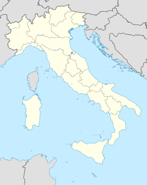
Valle di Casies Situasiù linguìstica | Evulusiù demogràfica | Menù de navigasiù46° 46' N 12° 11' EVedè sü la mapaSit uficiàl del cümü
Pagine che utilizzano TimelineArtícol in Lumbàrt OrientàlComun del Trentin-Sud TiroeulCumün de la Pruvincia Ütonuma de Bolzan
Trentino-Alto AdigePruvìncia de BolzanosuperfìcedensitàDobbiacoMonguelfoRasun AnterselvaVillabassa
Valle di Casies
Jump to navigation
Jump to search
| Chest artícol a l'è scricc in Lumbàrt Orientàl, ortograféa unificàda |
Valle di Casies (Gsies) | |
|---|---|
 | |
 | |
| Stàto | Itàlia |
| Regiù | Trentino-Alto Adige |
| Pruvincia | Bolzano |
| Cuurdinàde | 12°10′49″ E 46°46′09″ N Vedè sü la mapa |
| Abitàncc | 2 287 ab. |
| Superfìce | 109,0 km² |
| Densità | 21 ab/km² |
| Altèsa | 1 206 m s.l.m. |
| Cümü tacàcc | Dobbiaco, Monguelfo, Rasun Anterselva, Villabassa |
| CAP | IT-39035 |
| Còdes ISTAT | 021109 |
| Prefìs tel. | 0474 |
Sit uficiàl del cümü | |
Valle di Casies (Gsies) l'è 'n cümü italià, de la regiù del Trentino-Alto Adige, en Pruvìncia de Bolzano. El g'ha presapóch 2.101 abitàncc, 'na superfìce de 108 km² e 'na densità de 19 ab./km². El cunfìna coi cümü de Dobbiaco, Monguelfo, Rasun Anterselva, Villabassa.
Situasiù linguìstica |
Lèngua parlàda (cens 2001) | 98,47 % todèsch |
| 1,43 % italià | |
| 0,10 % ladì |
Evulusiù demogràfica |
Abitàncc censìcc

Categurij:
- Pagine che utilizzano Timeline
- Artícol in Lumbàrt Orientàl
- Comun del Trentin-Sud Tiroeul
- Cumün de la Pruvincia Ütonuma de Bolzan
(window.RLQ=window.RLQ||[]).push(function()mw.config.set("wgPageParseReport":"limitreport":"cputime":"0.840","walltime":"1.244","ppvisitednodes":"value":26223,"limit":1000000,"ppgeneratednodes":"value":0,"limit":1500000,"postexpandincludesize":"value":7297,"limit":2097152,"templateargumentsize":"value":554,"limit":2097152,"expansiondepth":"value":12,"limit":40,"expensivefunctioncount":"value":1,"limit":500,"unstrip-depth":"value":0,"limit":20,"unstrip-size":"value":242,"limit":5000000,"entityaccesscount":"value":1,"limit":400,"timingprofile":["100.00% 1186.898 1 -total"," 68.37% 811.428 1 Mudel:Comü"," 30.61% 363.273 1 Mudel:Demografia/Valle_di_Casies"," 24.36% 289.143 1 Mudel:Itageoloc"," 17.33% 205.738 2 Mudel:Superfis_IT"," 16.14% 191.573 3 Mudel:Longituden_IT"," 15.78% 187.278 3 Mudel:Latituden_IT"," 13.85% 164.340 1 Mudel:Altituden_IT"," 4.39% 52.152 2 Mudel:Coord/dec2dms/dms"," 1.40% 16.607 2 Mudel:Dati_pop_IT"],"cachereport":"origin":"mw1270","timestamp":"20190313194856","ttl":2592000,"transientcontent":false););"@context":"https://schema.org","@type":"Article","name":"Valle di Casies","url":"https://lmo.wikipedia.org/wiki/Valle_di_Casies","sameAs":"http://www.wikidata.org/entity/Q504650","mainEntity":"http://www.wikidata.org/entity/Q504650","author":"@type":"Organization","name":"Contributori ai progetti Wikimedia","publisher":"@type":"Organization","name":"Wikimedia Foundation, Inc.","logo":"@type":"ImageObject","url":"https://www.wikimedia.org/static/images/wmf-hor-googpub.png","datePublished":"2010-05-28T13:24:58Z","dateModified":"2013-03-10T06:09:07Z","image":"https://upload.wikimedia.org/wikipedia/commons/b/be/Italy_location_map.svg","headline":"comun italian"(window.RLQ=window.RLQ||[]).push(function()mw.config.set("wgBackendResponseTime":147,"wgHostname":"mw1330"););